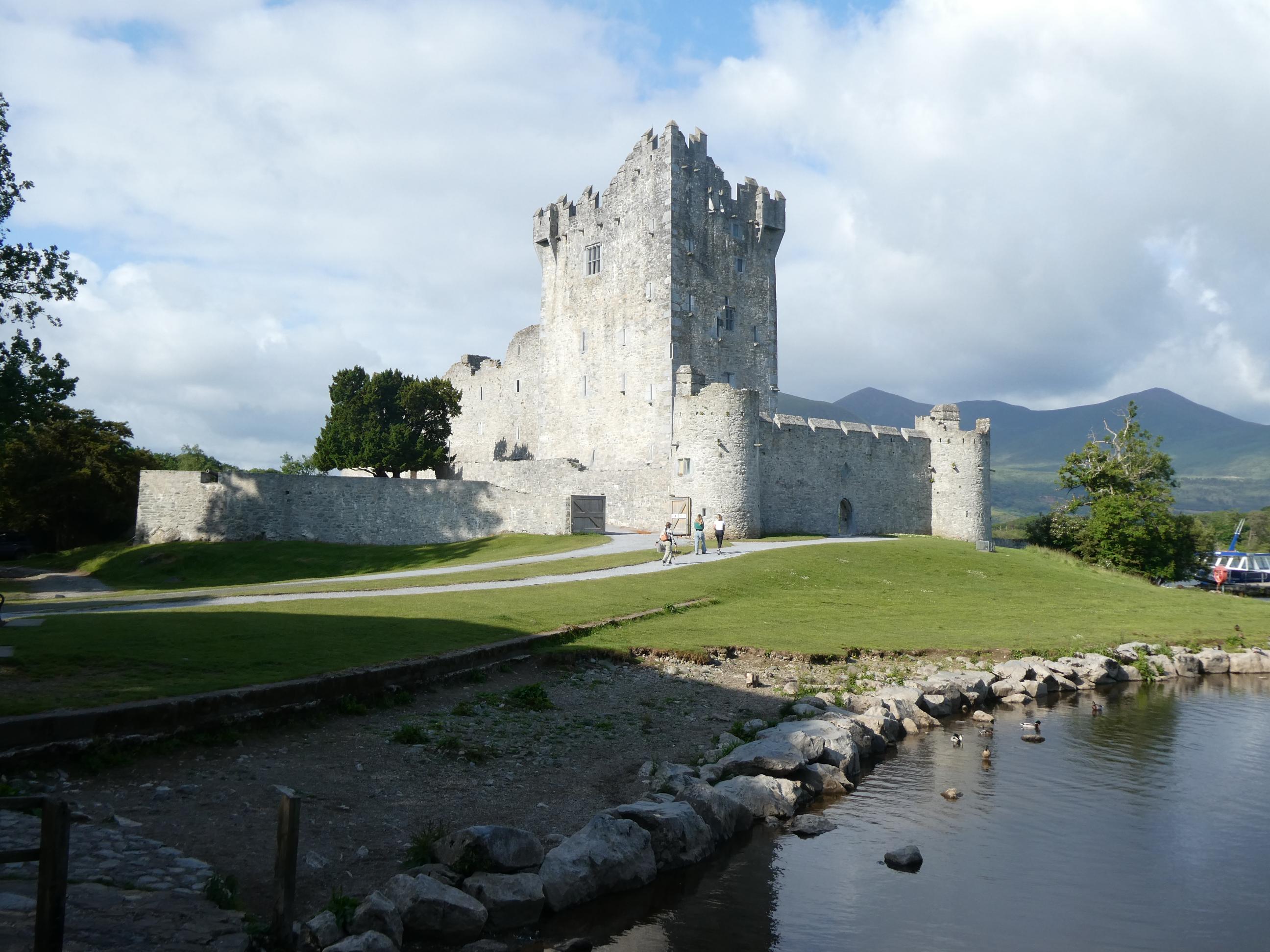
Our day began with a photo stop at Ross Castle, just a short distance from our accommodation in Killarney. We had planned to do that the previous day, but when we got caught up in the traffic jam connected with the free concert it would have been impossible. The sun was out and the day looked full of promise. We headed north-west through Castlemaine, birth place of the ‘Wild Colonial Boy’, which is acknowledged as you drive into the town. From Castlemaine, we drove west towards Inch Beach. To our immediate left was Castlemaine Harbour, and across the water was the Ring of Kerry road we drove yesterday.

Inch Beach, or Inch Strand as it is signposted, is a long, broad sandy beach, popular with surfers. Although it was not a cold morning, there was a chilly wind coming in off the water, and I would have thought it was too cold for swimming. One woman ventured down to the water in her swimming costume, but didn’t go in. After a while, she turned and walked away from the water. No doubt she was hoping for a warmer day. One guy was out surfing and another group were having surfing lessons. We grabbed one of the few spots in the car park, but quite a few people brought their cars down onto the sand and drove along the beach. The sun was trying to break through the clouds, but soon it disappeared as grey clouds rolled in, casting a dark shadow over the beach. It was time to move on.


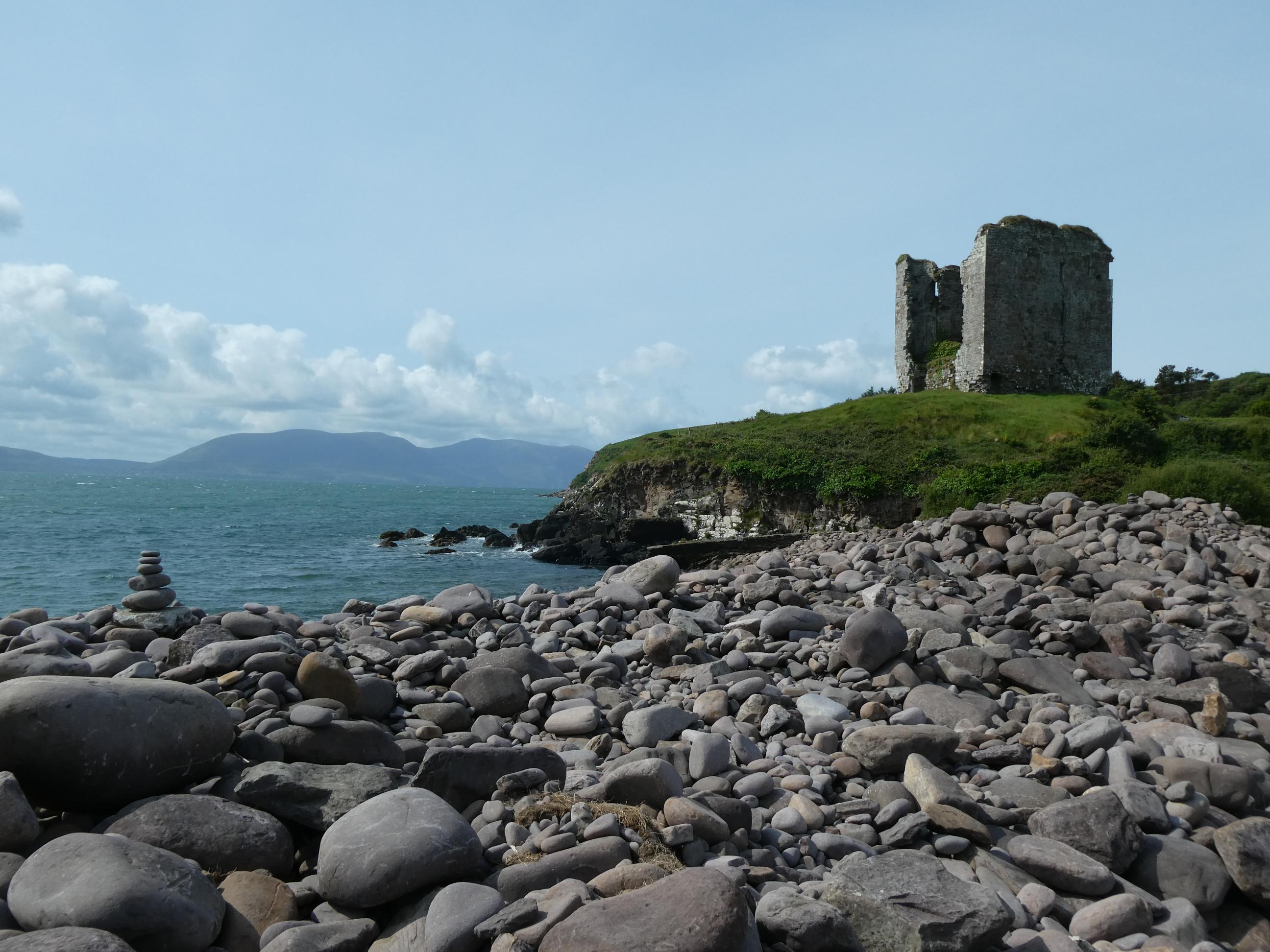
We stopped for more photos at Minard Castle, though we didn’t walk all the way up to it. The castle is just a ruined tower these days, but it sits in a beautiful location on a hill at the edge of a rocky shore, looking across the North Atlantic to the Iveragh Peninsula, where we visited yesterday. The castle once belonged to the powerful Fitzgerald family, but it was destroyed by cannon fire in 1650 by Oliver Cromwell’s army. In the 1960s, the tower featured in the epic movie, ‘Ryan’s Daughter’.


Just short of reaching Dingle, we turned north-east and began a winding climb on a road that cuts across the peninsula from south to north. At an elevation of 456 metres, its highest point, the road passes between two mountain peaks at Conor Pass, before beginning its winding, steep descent on the other side. It’s one of Ireland’s highest mountain road passes. We stopped in the carpark at the pass for photos. It was a beautiful view down the valley. Strong, chilly winds made it difficult to open and shut the car doors, let alone walk upright. Some cyclists had made it all the way up, and we’d even passed some walkers, low down on the slope, who seemed to be heading towards the pass. I watched one guy, wearing only shorts, leave the carpark and head even higher up towards one of the peaks. I don’t know how or why he would attempt it in those strong winds. The notes Rod had gathered in preparation for today said that the descent on the far side of the pass was the ‘stuff of nightmares for nervous drivers’, so we opted to turn the car around and head back down the way we’d come. That was still a very steep, curving descent that kept drivers vigilant all the way down. We passed one guy on a bike who seemed to be having a hard time keeping it under control and couldn’t even move over to the side of the road to let us pass. He had one foot off the pedals and appeared to be using it to try to slow himself down. Thankfully, the road itself was a well maintained asphalt road with a strong safety wall preventing anyone from going over the edge. I hope he made it safely to the bottom eventually. The road brought us into Dingle, where we stopped for lunch.


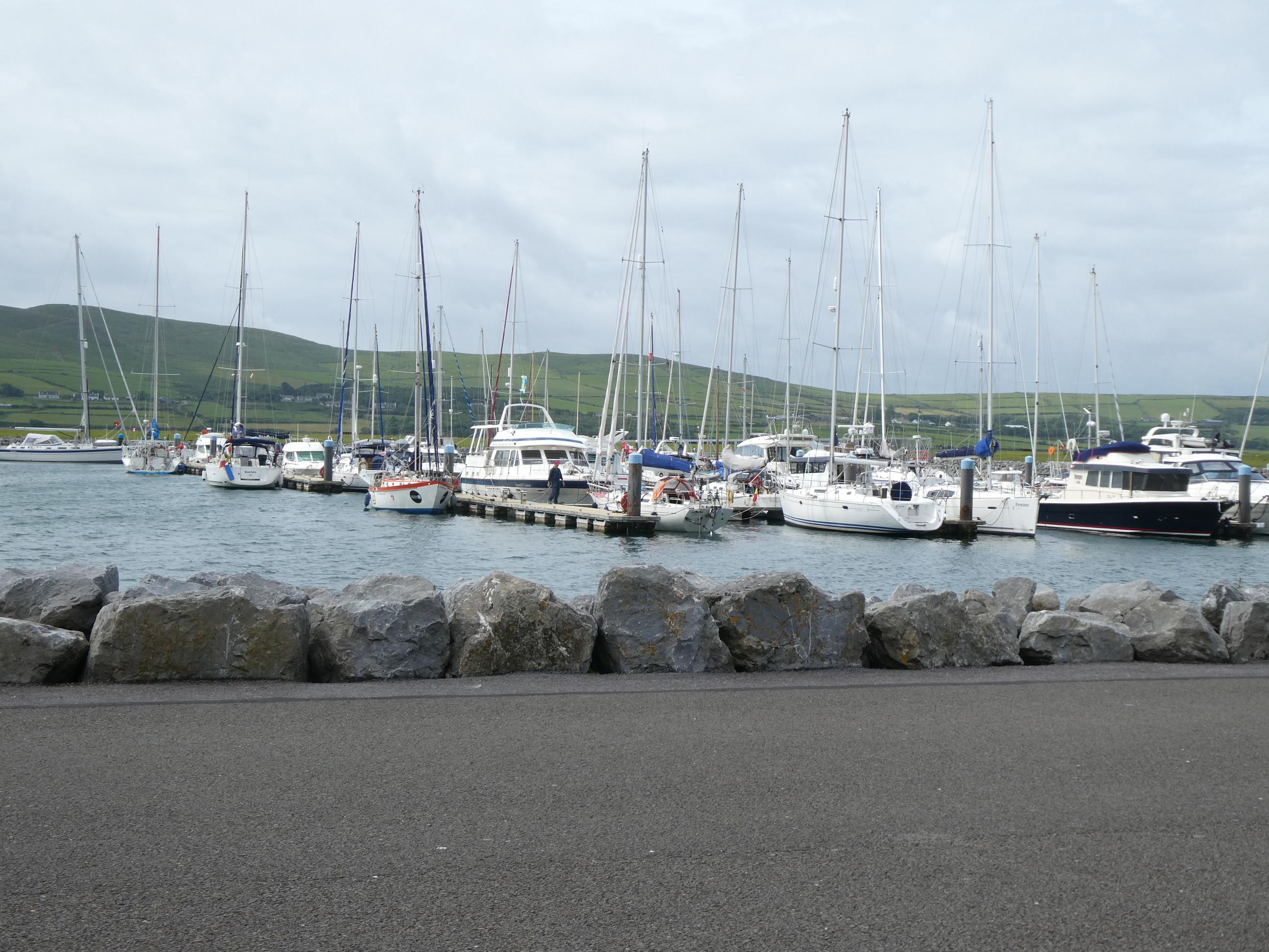
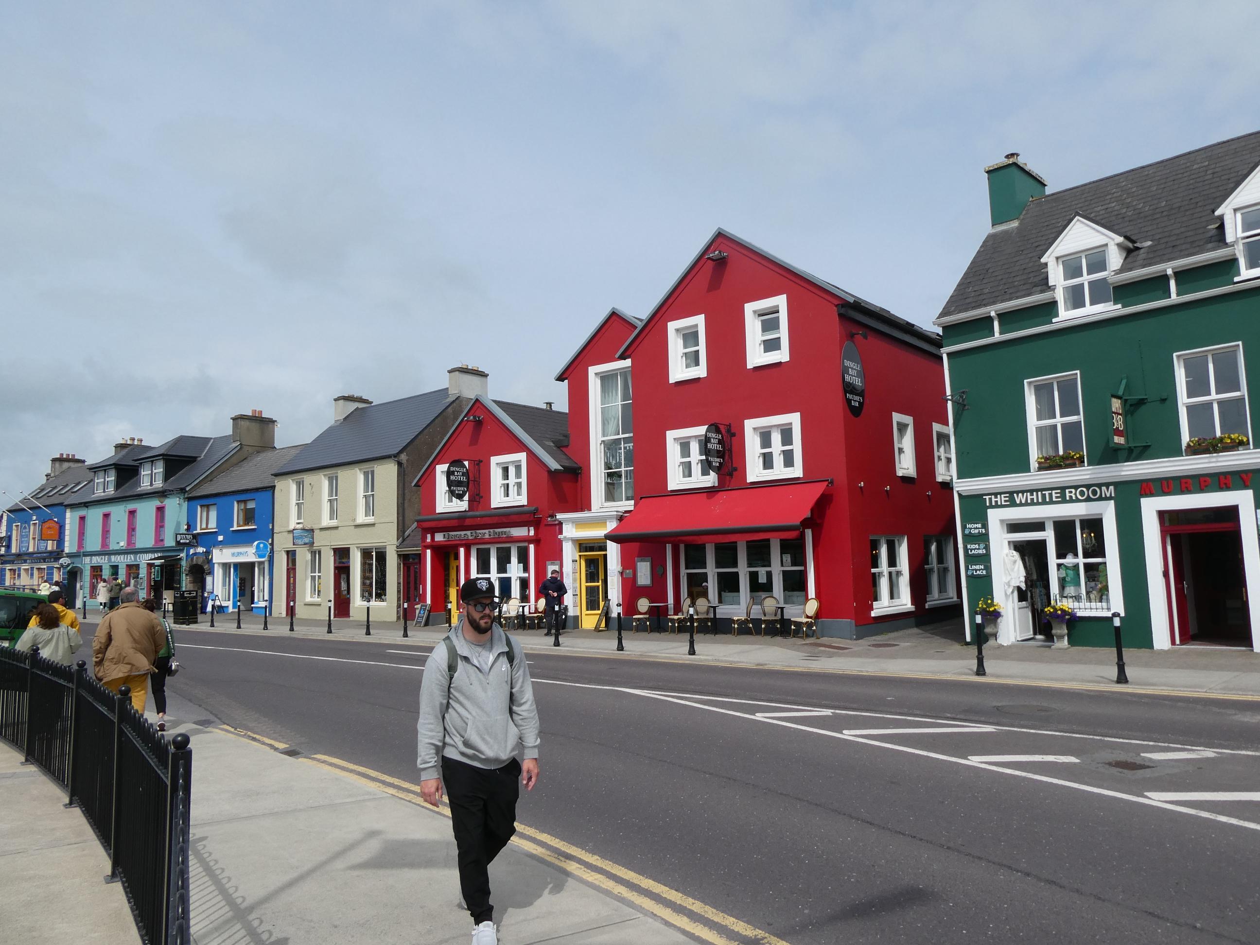
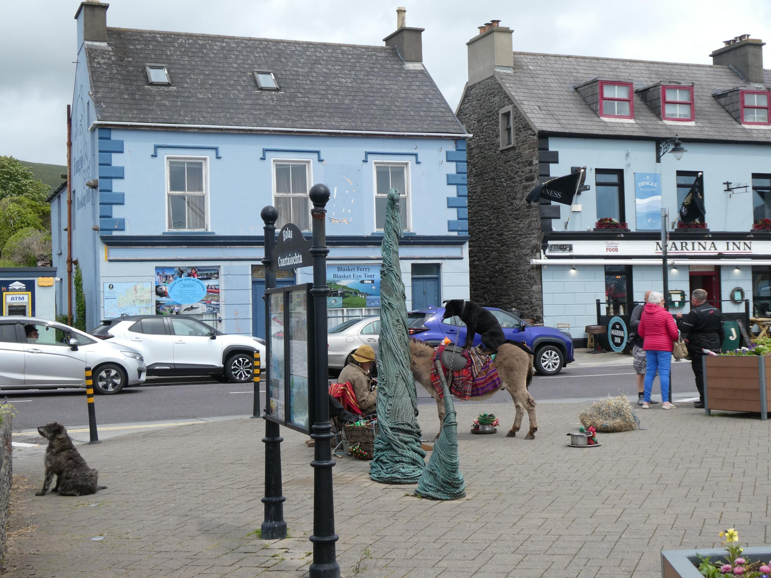
We parked near the marina and took the opportunity to stroll around Dingle’s streets. It’s a very colourful town, with a few touristy places and a lot of pubs. Right over the road from one pub was a temperance hall. I imagine there was a time when you might have found a woman in the temperance hall attending a meeting about the evils of alcohol at the same time that her husband was downing a few pints in the pub across the road.


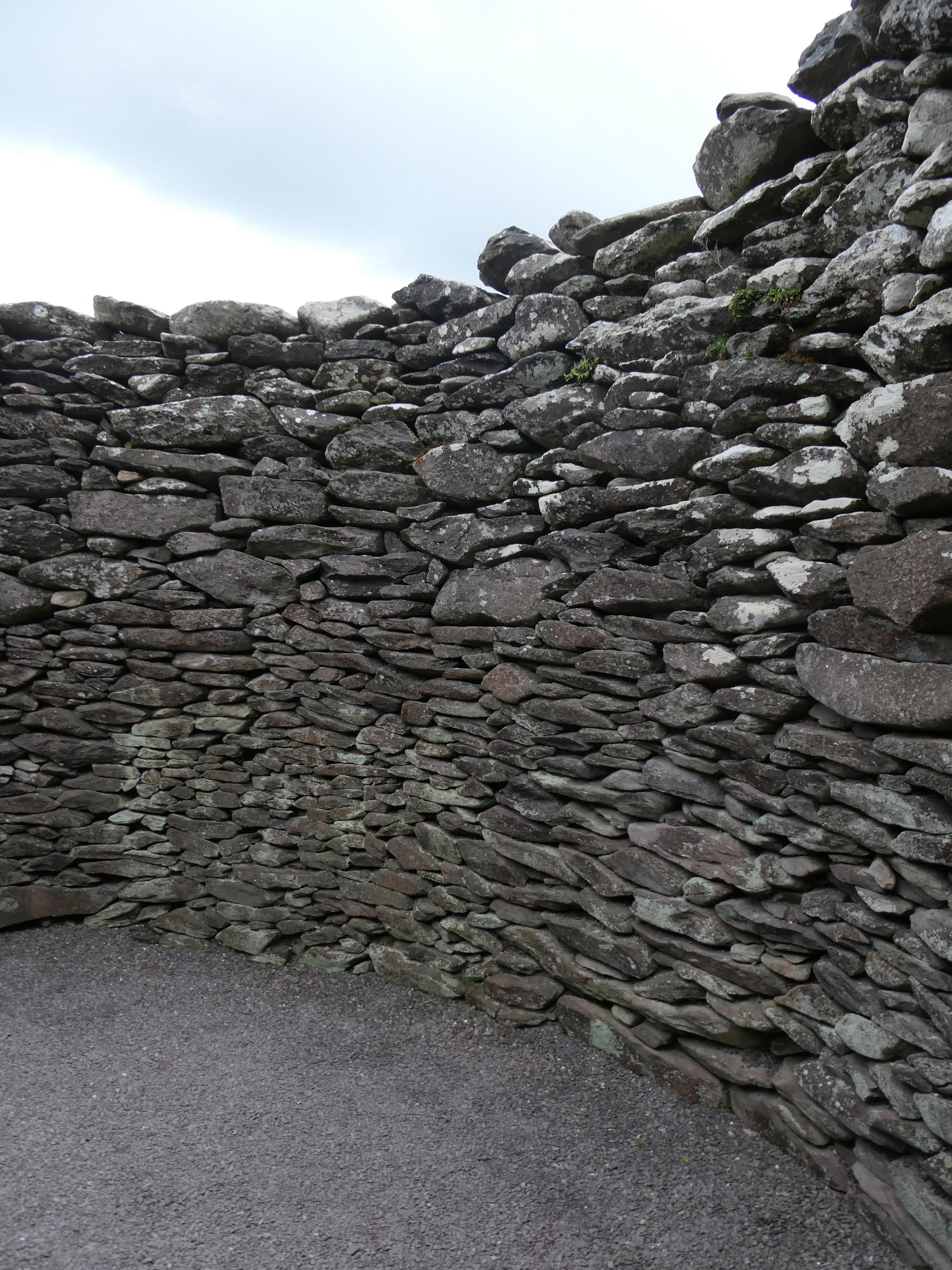
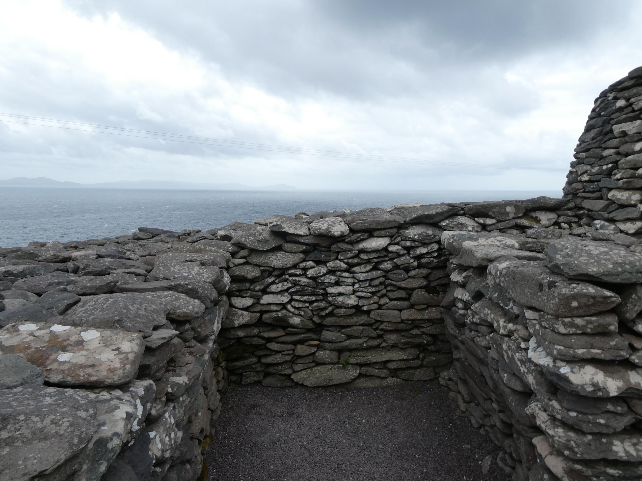
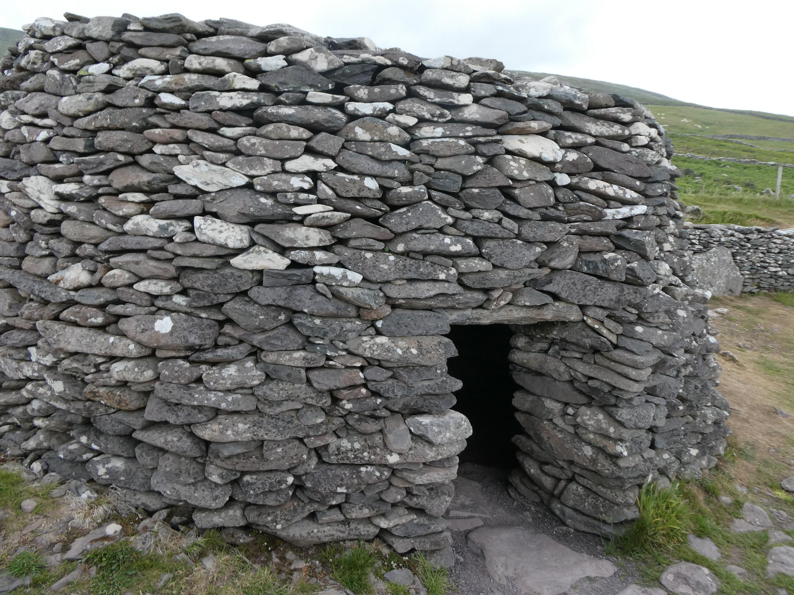
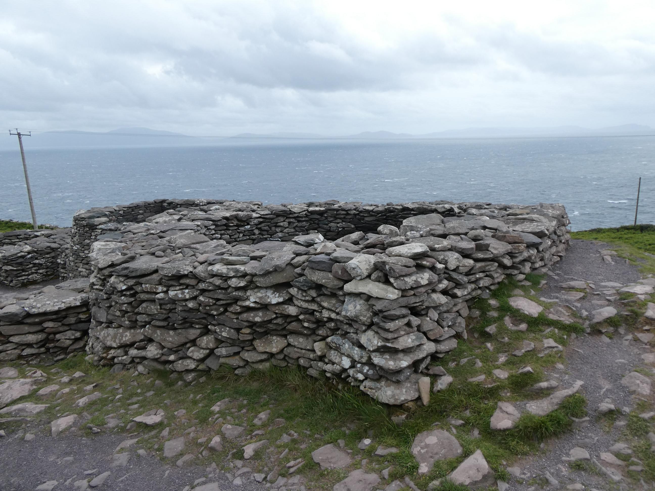
A little farther on from Dingle, at Fahan, we pulled up at a layby and walked a couple of hundred metres up a slope to a group of round stone ‘beehive’ huts. There appears to be no exact time frame to when they were first built, but it seems they may have last been in use around 1200 AD. Like the ringforts we visited yesterday, the beehive huts were created only by placing stones upon other stones. No mortar was used. It’s likely that a single family occupied each beehive hut. It would have provided protection, shelter and storage space for farm produce. As well as similarities with yesterday’s ringforts, the beehive huts, or clochans as they are otherwise known, reminded me of some the stone structures I’d seen at Skara Brae in Orkney and Jarlshof in Shetland. Once again, the strong icy wind was whipping through here. It was a relief to step inside one of the huts to escape the wind for a while.
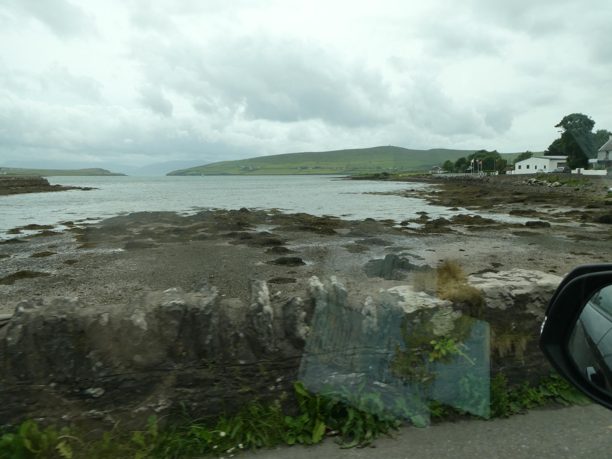

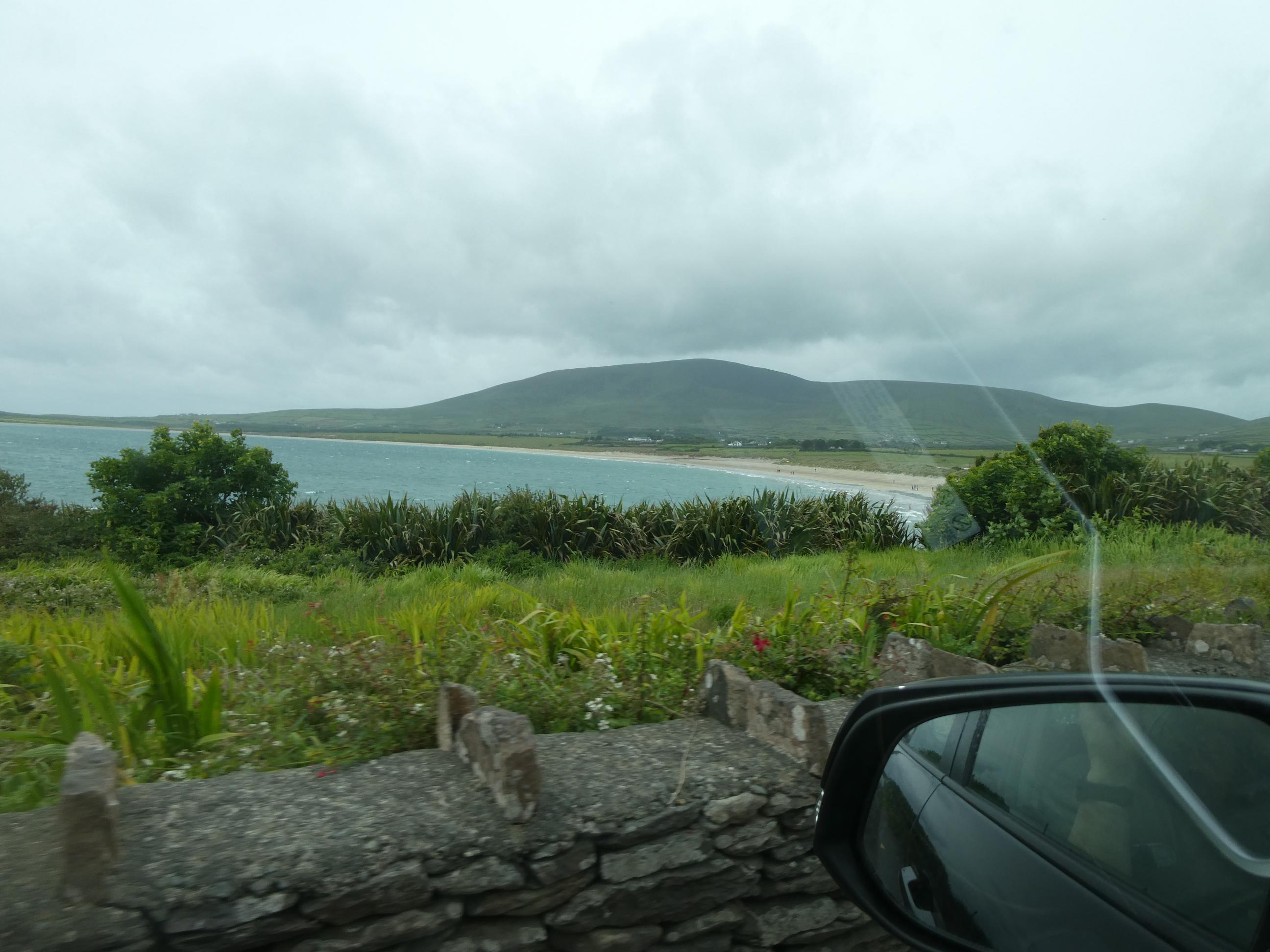
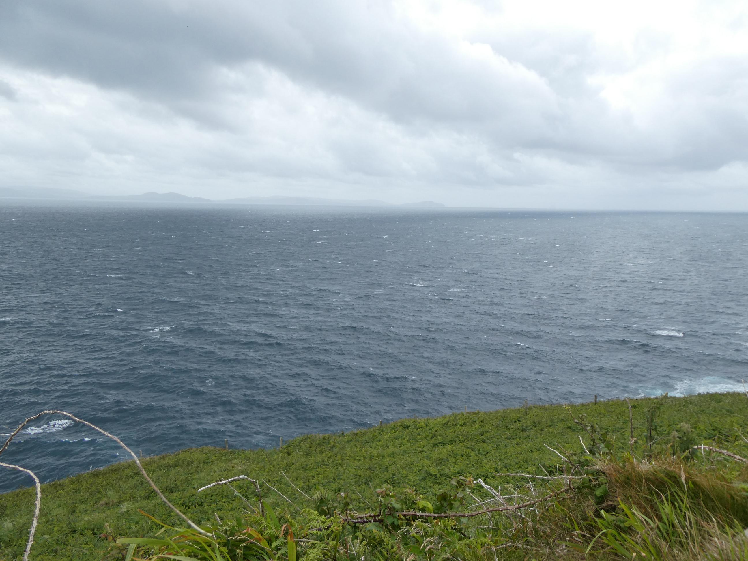


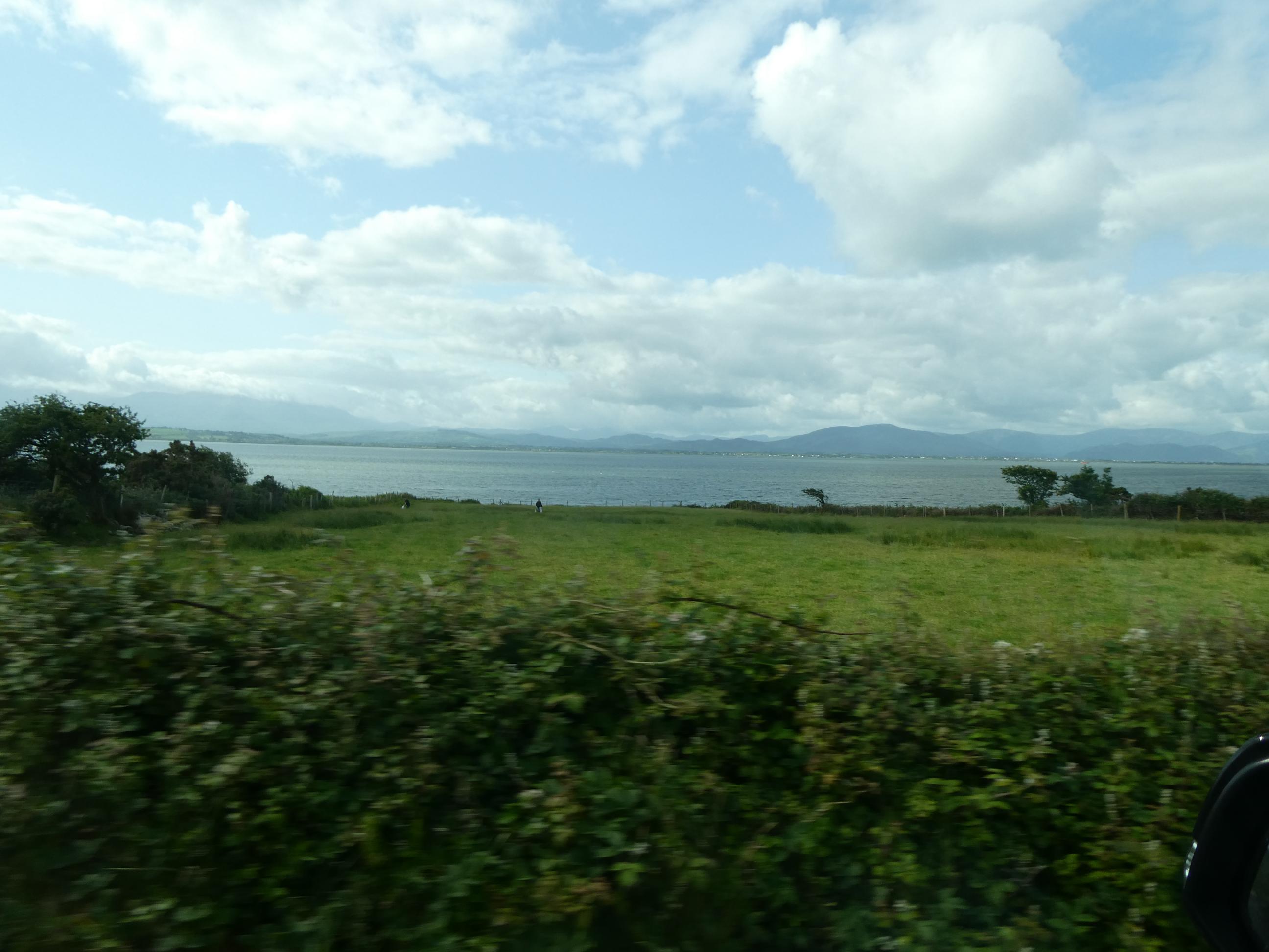
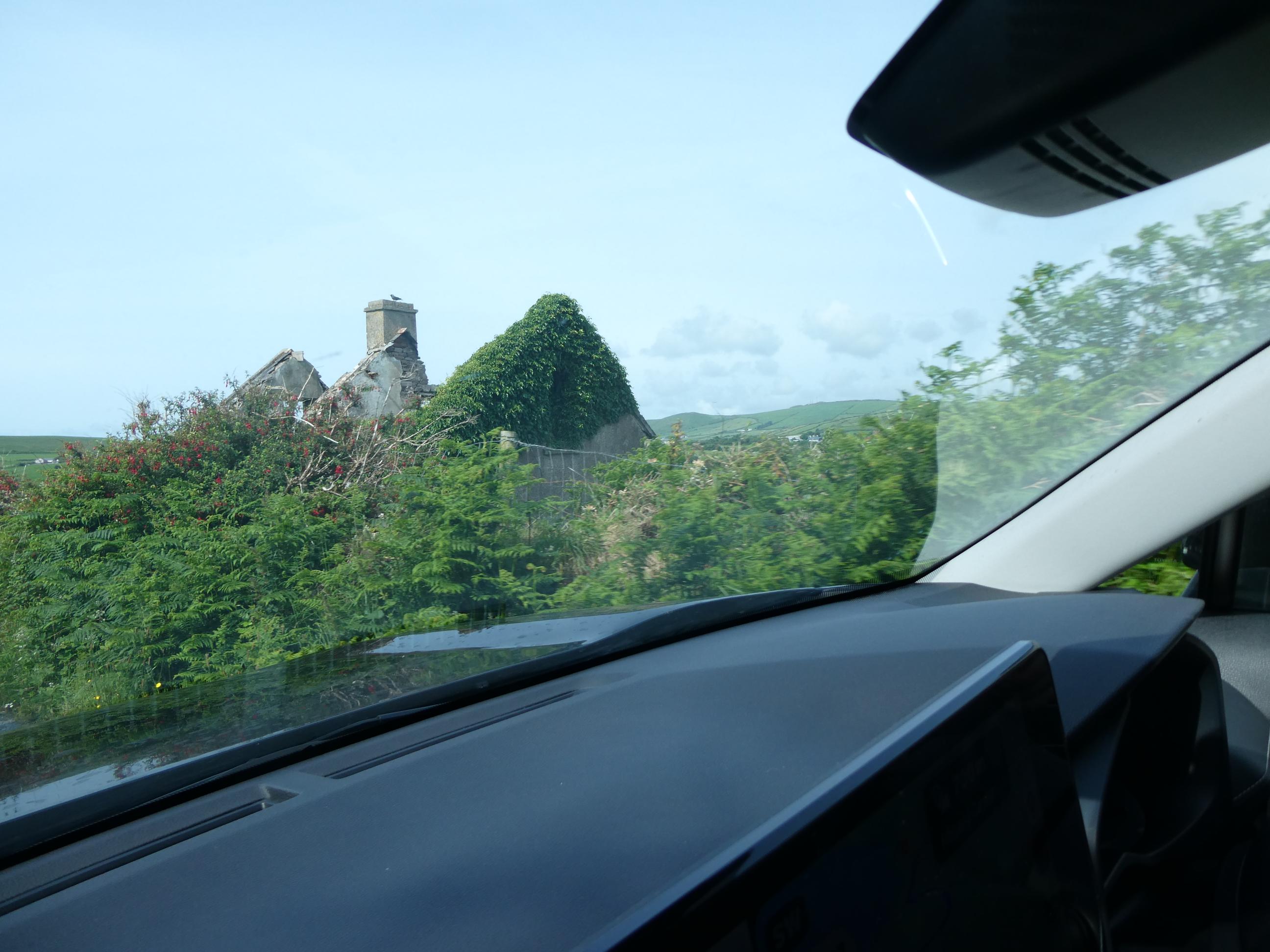
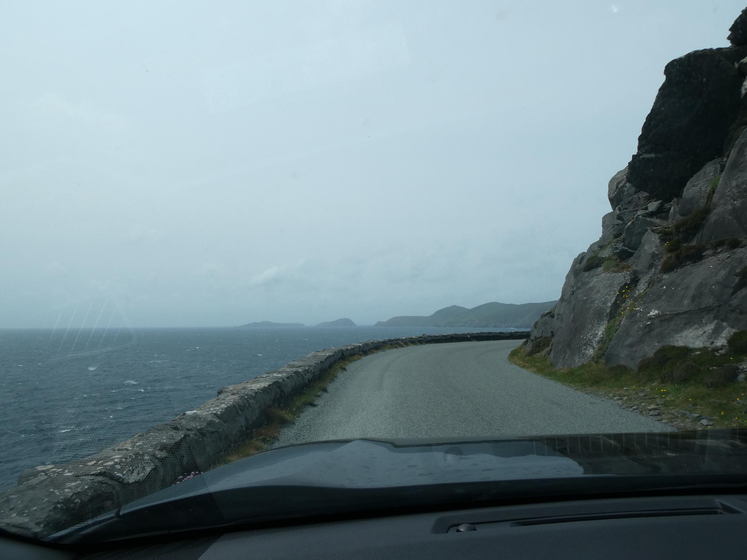
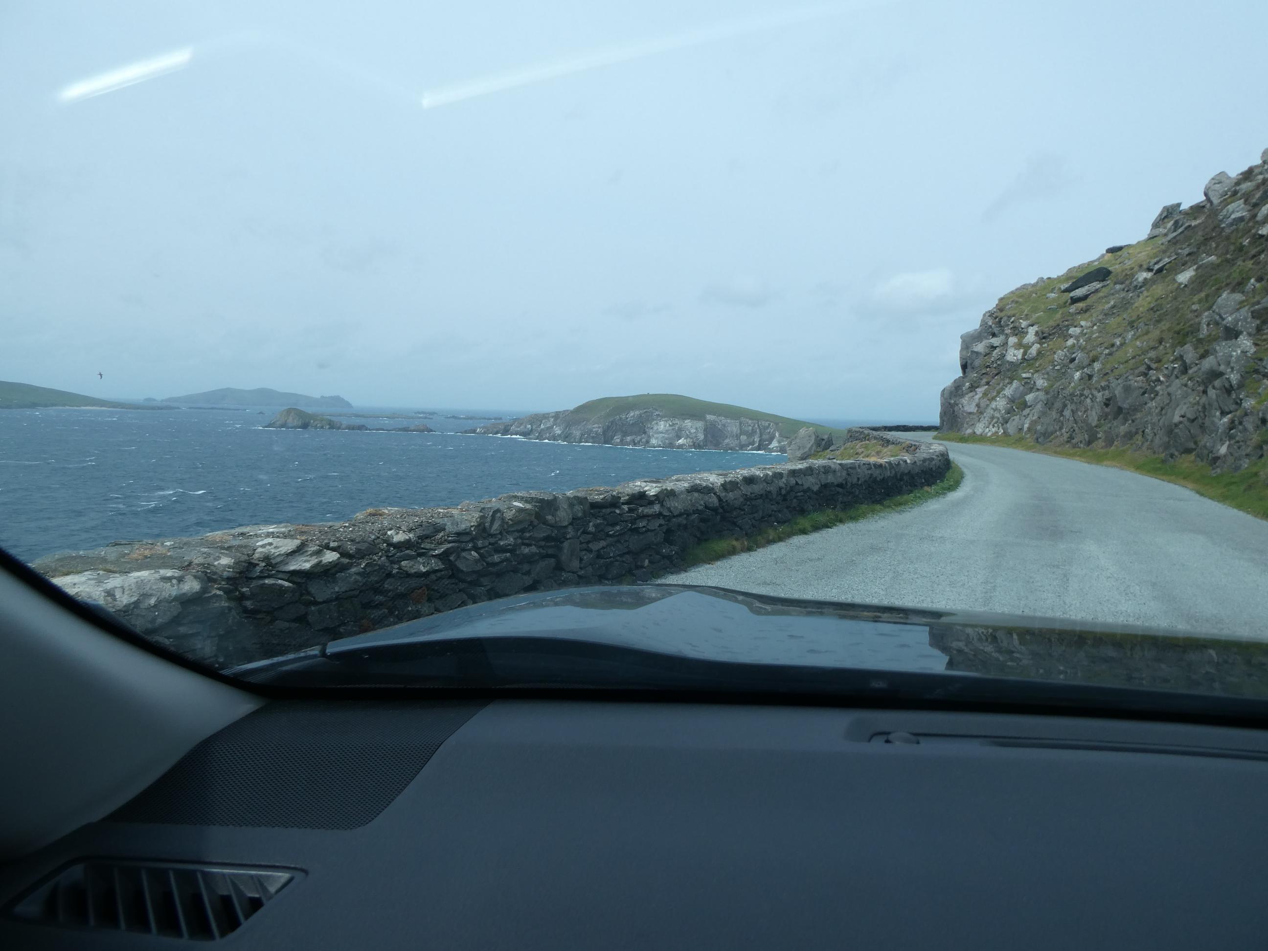
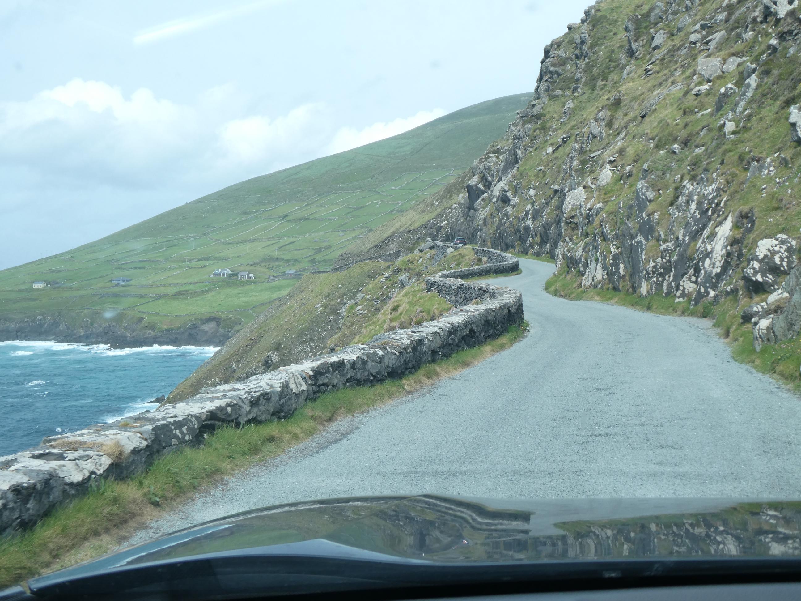
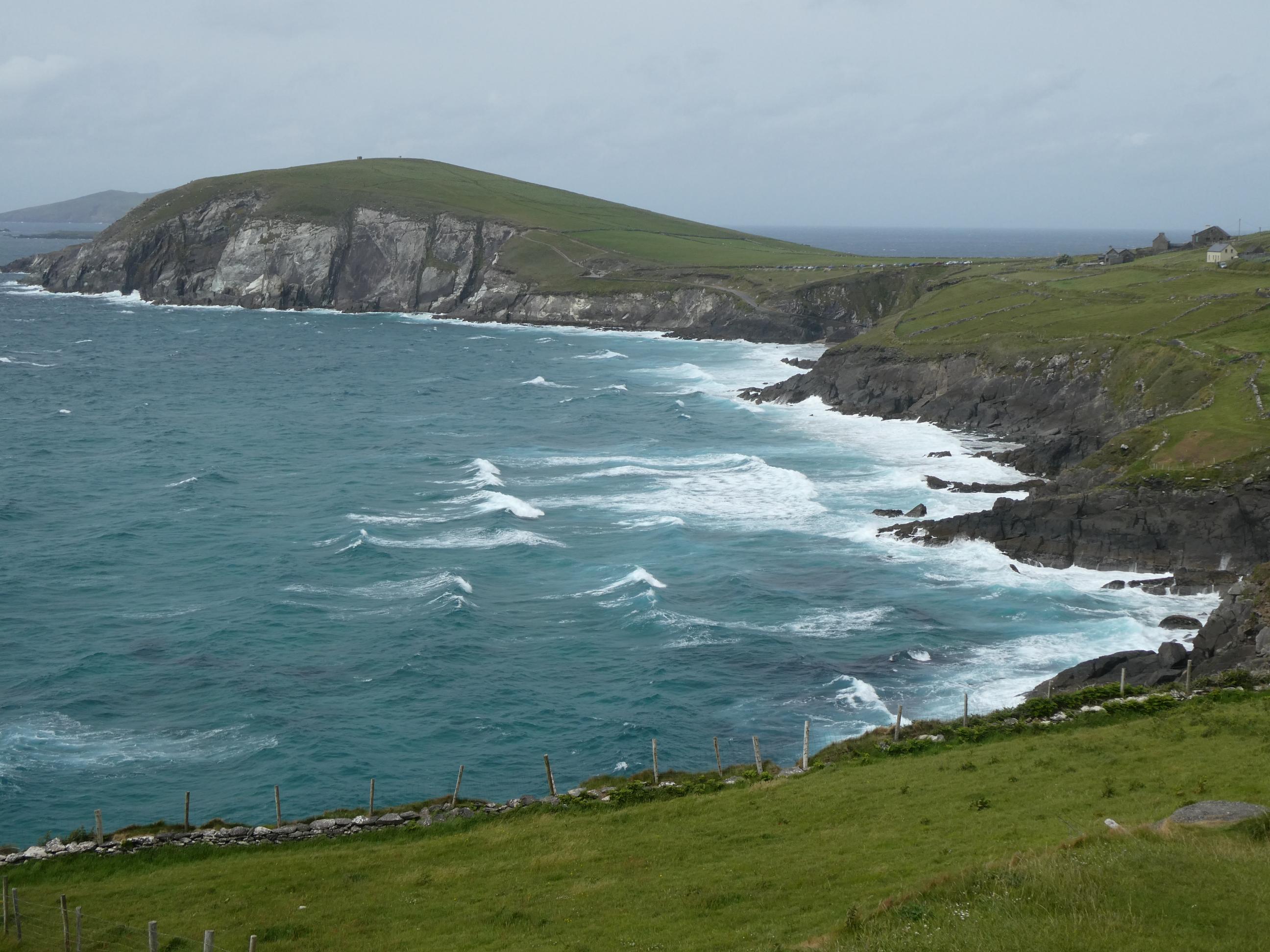
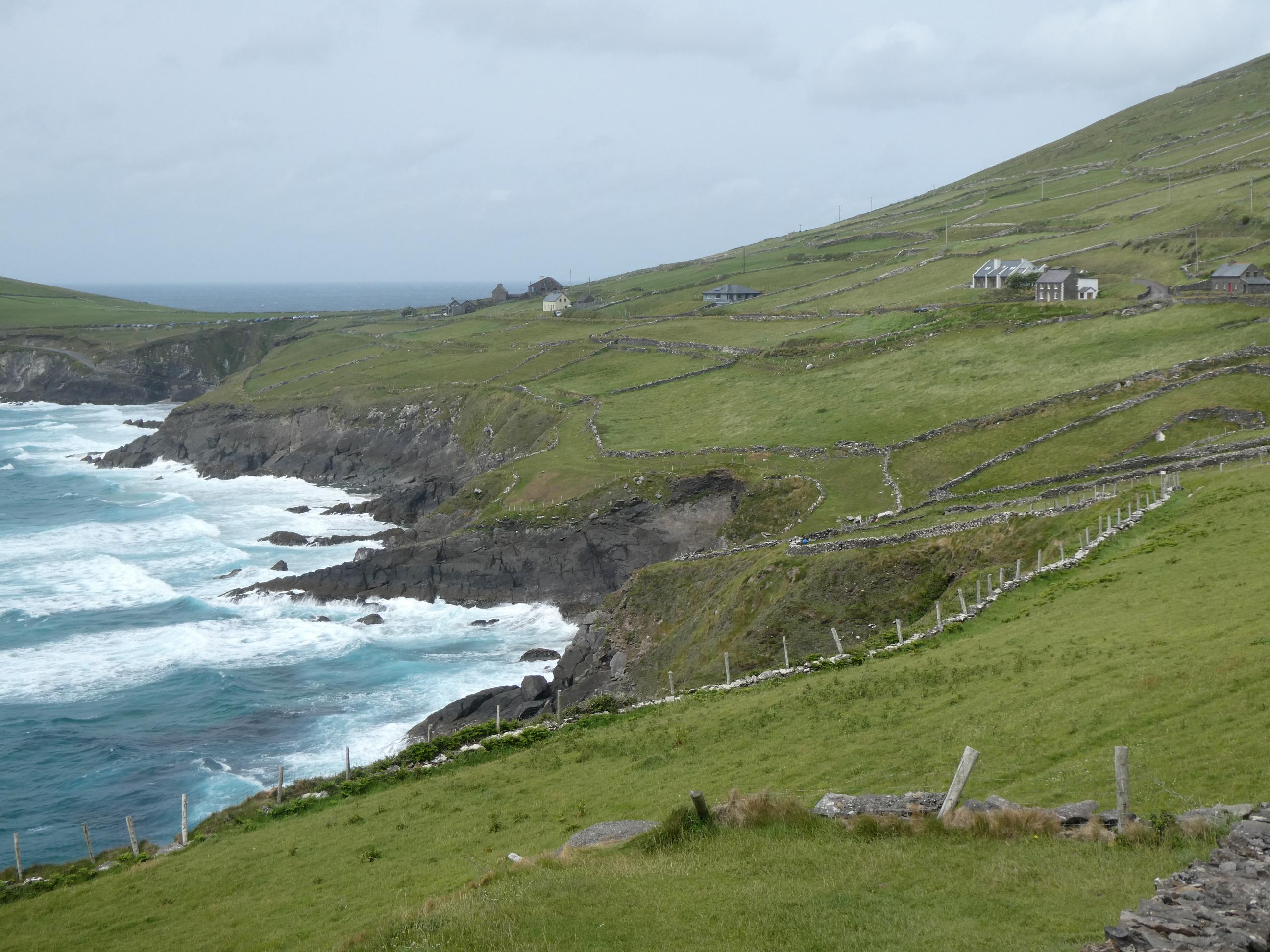
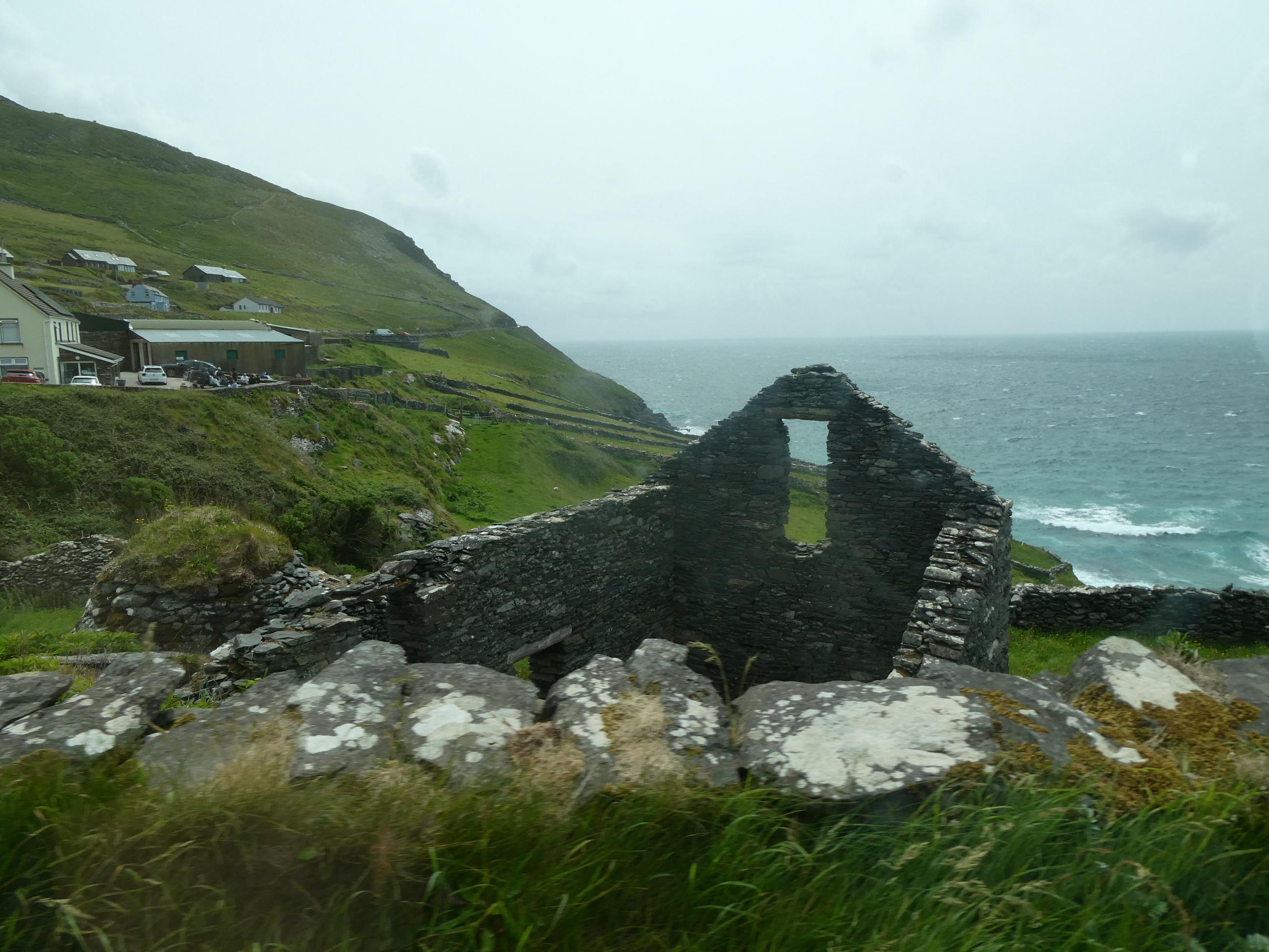
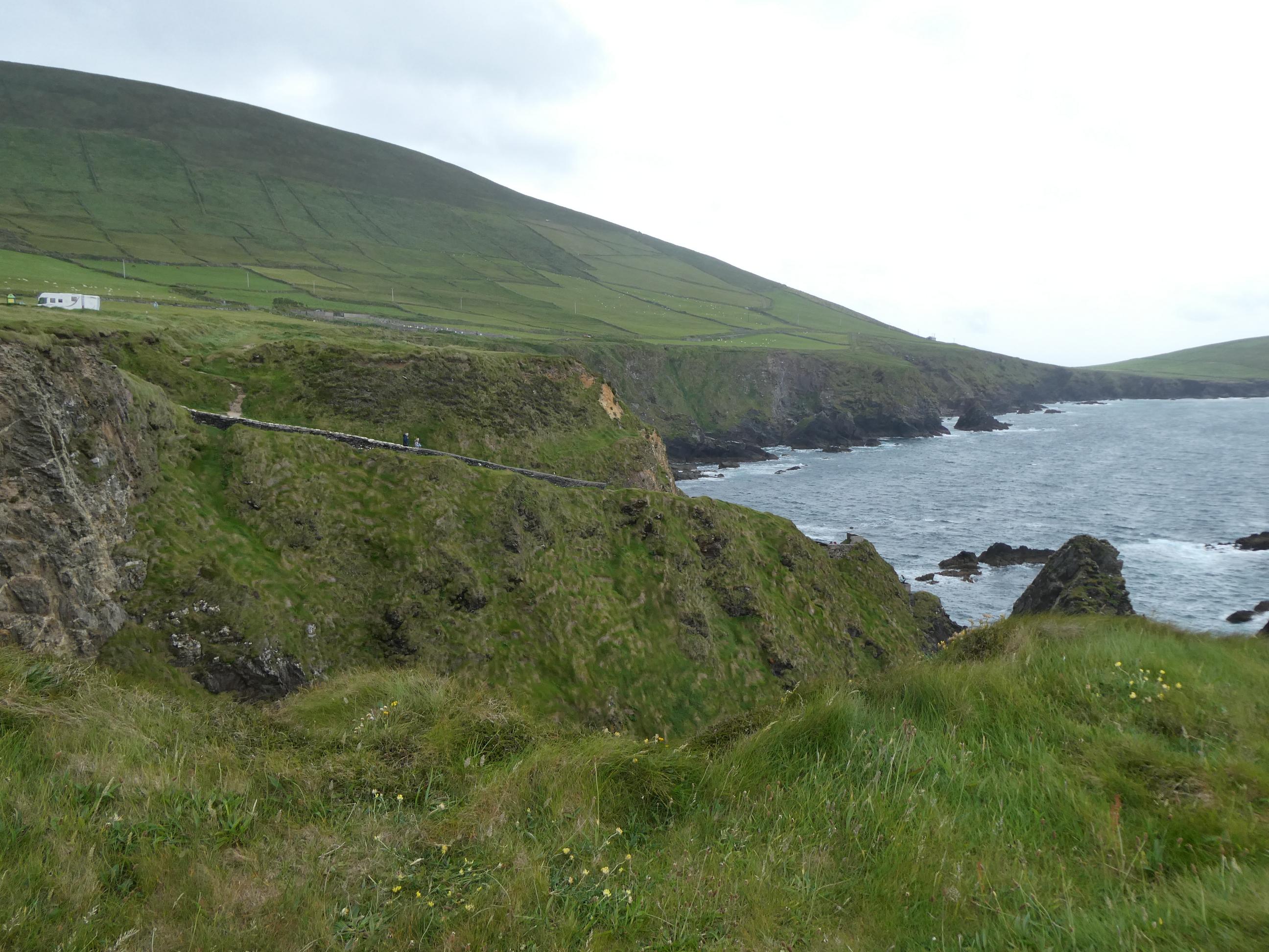
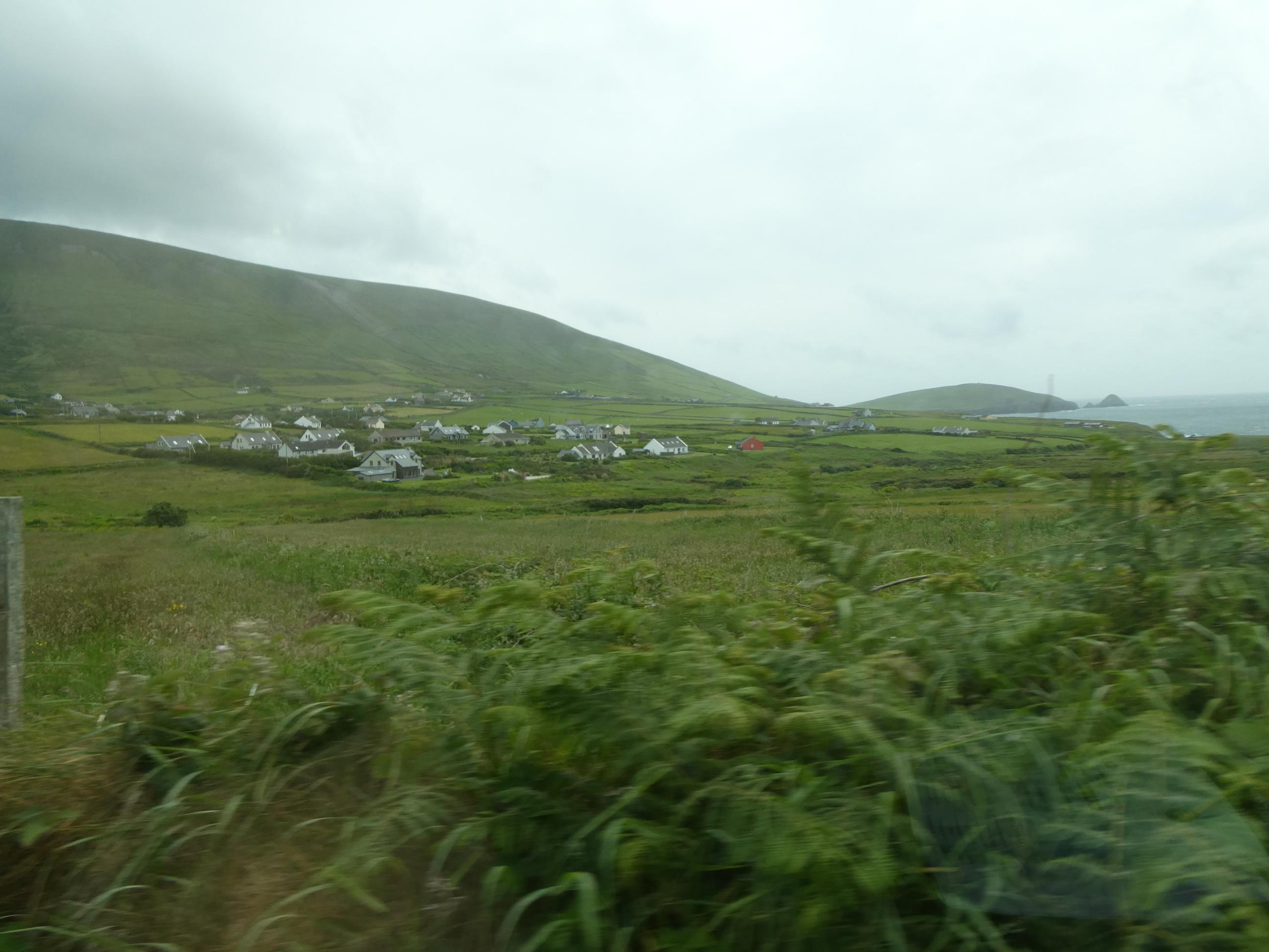
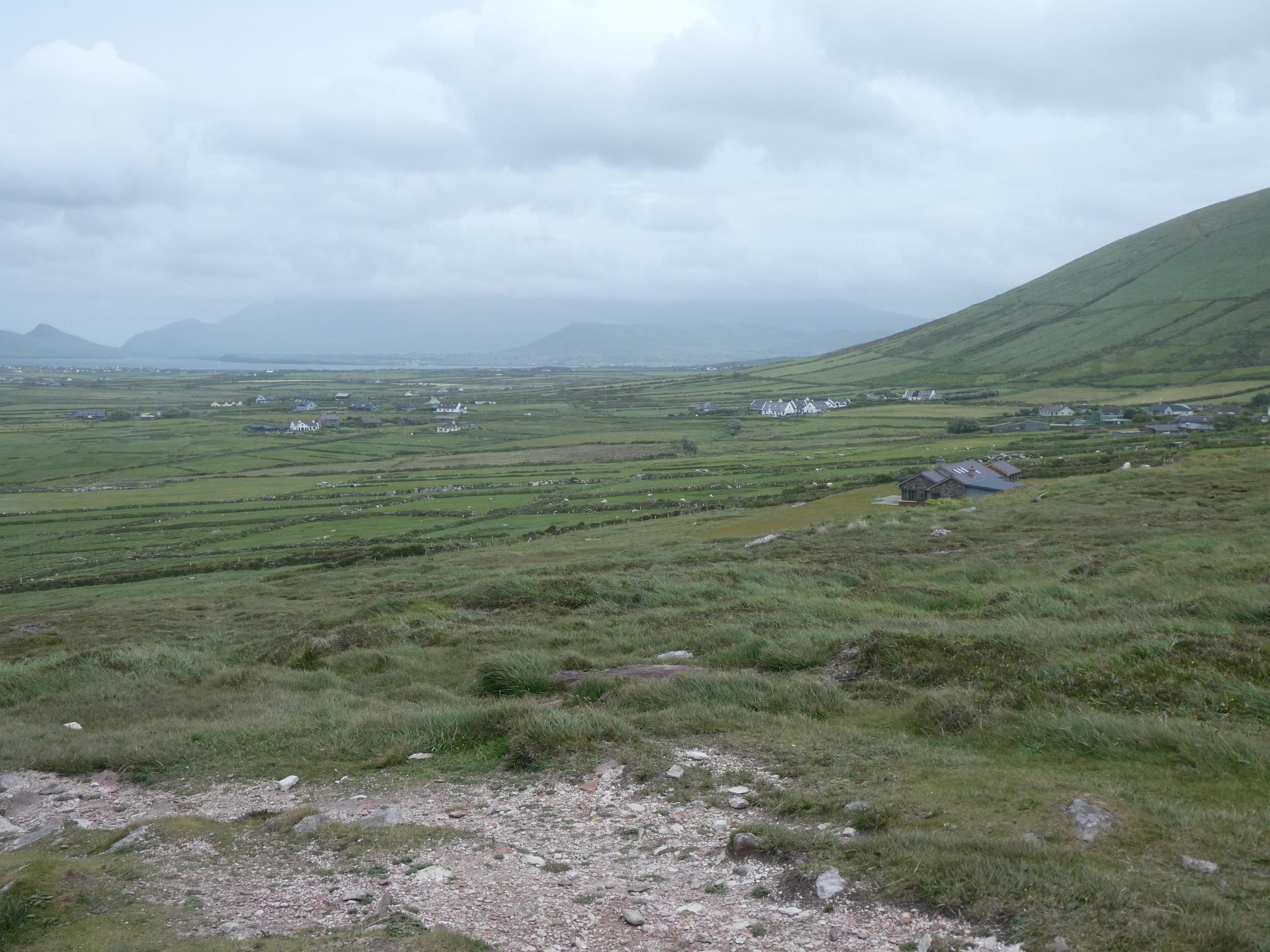
This part of the drive was known as the Slea Head scenic route. Essentially this was a loop that started in Dingle and followed the coastline in a clockwise direction around to Gallarus, before cutting back across the peninsula to Dingle again. From Fahan around to Dunquin Pier, the road is elevated, narrow and windy. It hugs the side of a steep hill with a long drop to the choppy water below. It’s a great little drive for the passengers because the views are fantastic, but the poor driver needs to keep his eyes on the road and his hands on the wheel because a car coming from the other direction might suddenly appear just a short distance in front, causing both cars to find a passing place where they can carefully squeeze past each other before continuing their journeys. The reward for all of us today was a parking space available at Blasket’s View, from where we could enjoy the beautiful views over to the Blasket Islands. No one lives on those islands anymore. The last people to leave were evacuated in 1953. You can see much of what I love about the west coast of Ireland in some of the photos below – green fields, hilly slopes, surging sea, stone fences, isolated cottages, ruined structures … and wind (you can’t see it, but believe me, it was real).


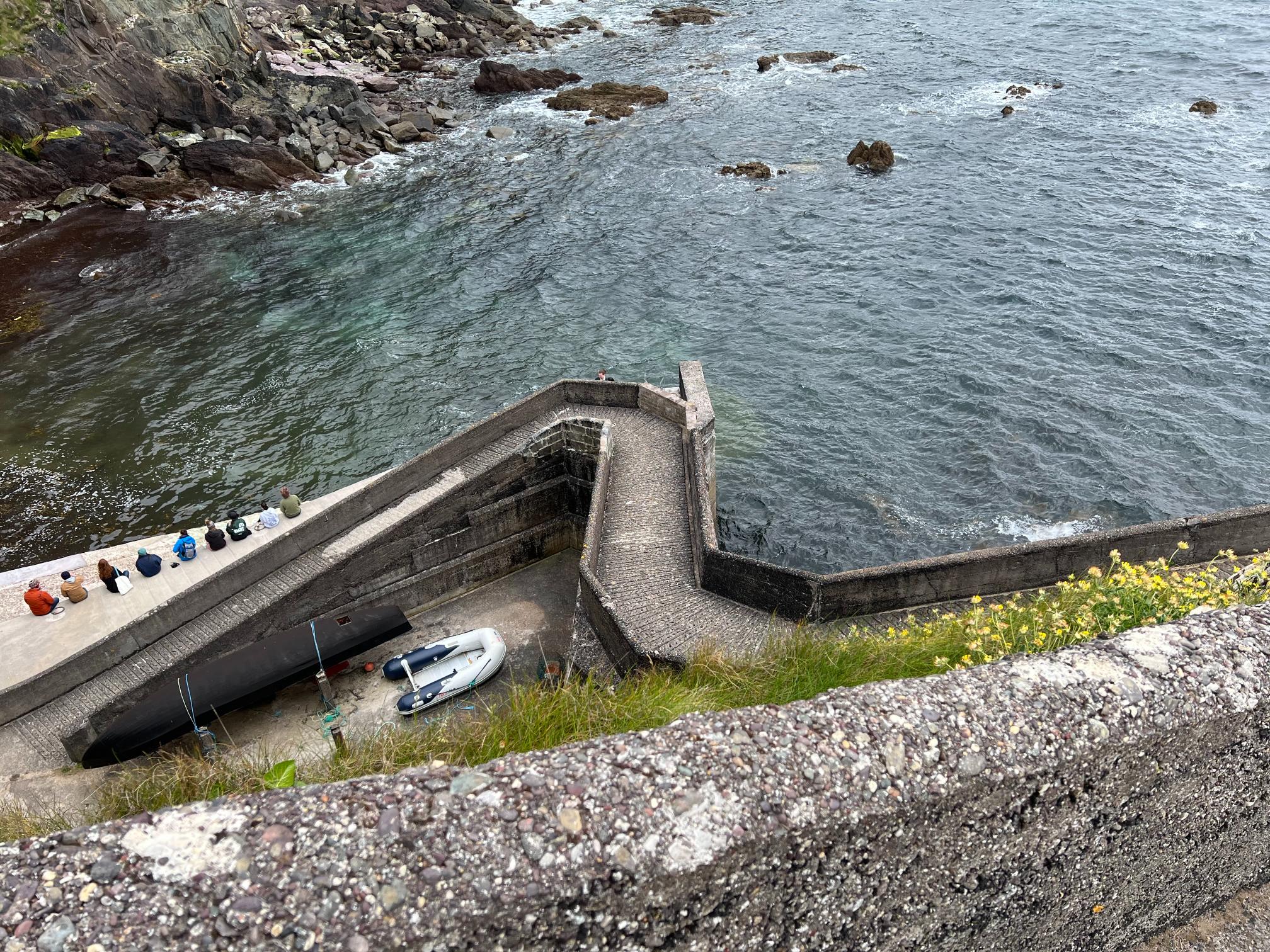
The wind was at its worst at Dunquin Pier. I forgot to mention that a large percentage of the population of the Dingle Peninsula are Gaelic speakers, and that each of the placenames I’m mentioning also has its proper Gaelic equivalent. Dunquin Pier, for example, is Cé Dhún Chaoin. Travellers’ notes suggested it was one of the strangest piers in Ireland. It was here the wind was at its absolute strongest. At one stage, when I ventured out into an open space, I was blown back a step or two and it was a struggle to move forward. I turned to Marg about five metres behind me and suggested that she didn’t come any closer. We both sought somewhere with a little shelter from the strongest gusts. Rod and Cornelia walked down the steep path to the pier. Marg and I didn’t go. Rod supplied the first photo. It must have been challenging bringing goods up from the pier in earlier times. The area around Dunquin Pier was also a filming location for ‘Star Wars: The Last Jedi’.


Coumeenoole Beach, a little further round the coast, was another filming location for ‘Star Wars: The Last Jedi’, as well as for ‘Star Wars: The Force Awakens’. Dunmore Head nearby also appears in the first of these. We got out of the car for photos, nearly got blown away by the wind, and got back into the car again as quickly as we possibly could. This was our last view of the fabulous Dingle Peninsula coastline before we headed back to Dingle and then took the road we came in on back to Killarney. Rod posed the question of which drive had been our favourite. The Ring of Kerry or the Dingle Peninsula? That’s a hard choice. I loved them both. I think I’ll have to sit on the fence for this one.


Amazing views and photos.
LikeLiked by 1 person